
What Is A Subdivision ?
Until 1929 when cities and counties were granted authority to regulate subdivisions, lots in California were solely created by deed conveyance and not by map recordation. Before 1893, recording subdivision maps was a voluntary action, which was used for easier identification of lots in deeds of sale as an alternative to lengthy textural metes and bounds descriptions (Gardner v. County of Sonoma, 92 Cal. App. 4th 1055) . Between 1893 and 1929, however, the Subdivision Map Act did not regulate the design and improvement of subdivided lots, and therefore, a map recording alone did not create “legal” lots (Witt Home Ranch, Inc. v. County of Sonoma, 165 Cal. App. 4th 543, 2008 ) Until 1972 , up to four subdivided lots could still be legally created by deed conveyance unless a jurisdiction had a local Parcel Map ordinance. Today, the Subdivision Map Act:
- prevents fraud and exploitation
- protects public health and safety
- controls the design of improvements
- regulates the division of real property
- protects public and private property interests
- requires soil and geotechnical investigations
- encourages and facilitates orderly community development
- coordinates planning with community patterns established by local authorities
- ensures proper improvements are constructed so the area does not become a burden on the taxpayers
- affords public notice and an appeal process for interested persons and landowners who may otherwise be deprived of their property rights
- prevents the commencement of building construction (except for model homes) until the Parcel Map or Final Map has been recorded.
How Are Subdivisions Regulated ?
With a few exceptions,—-developed and undeveloped land in California cannot be divided for sale, lease, or financing without approval by the local jurisdiction. California regulates land division through the Subdivision Map Act (Government Code section 66410 et seq.). A recorded subdivision map converts a former single parcel or group of contiguous parcels into separate lots as they appear on the map. Jurisdictions may further regulate the subdivision process through local ordinances, including the General Plan, Specific Plan, Zoning, Development Fees, Infrastructure Improvements, Condominium Conversions , Hazard Zones (e.g., seismic , fire , flood), and Environmental Impact Reports. Real property may be divided horizontally (i.e., from the center of the earth to the heavens above) and vertically (e.g., transit rail structure beneath or above a building). The interface between the Building and Fire Codes and vertical subdivisions is complex, including access through property lines (e.g., elevator, stair, and utility shafts) and structural support on adjoining lots. Condominiums, which are not vertical subdivisions, avoid these complexities. The Subdivision Map Act and local relevant ordinances do not apply to the division of a parcel through a County Assessor’s tax foreclosure sale . The purchaser of one or both parts of a tax-sale parcel is entitled to a Certificate of Compliance ,(OAG 11/9/1981 No. 81/405, Vol. 64, p. 814) . Subdivision Types The SMA provides both a condensed process (i.e., Parcel Map) and an expanded process (i.e., Final Map) for approving land divisions. With a few exceptions , the demarcation between the processes is simply the number of new lots, condominiums, community apartments, or stock cooperatives being created:
Unlike Final Maps, Parcel Maps:
- need not be co-signed by the City/County Engineer (City/County Surveyor approval is sufficient)
- need not have public infrastructure constructed until building construction commences
- need not an additional approval and a public hearing by a City Council or County Board of Supervisors after approval by the City/County Surveyor.
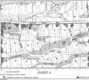
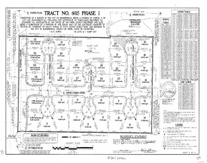
As the names imply, the end-result of both processes is a scaled diagram (i.e., Map prepared by a Land Surveyor) or “grandfathered” Civil Engineer showing the metes and bounds (compass bearings, distances, monuments) of the property lines of the new lots and associated easements and rights-of-way. Map approvals are typically “conditioned” with requirements for dedicating public and private easements (e.g., utilities, solar access) and public land (e.g., right-of-way, parks) and constructing publicly maintained improvements (e.g., sewers, streets), which are customarily identified during theTentative Map. Tentative Maps are required for all Final Maps and may be required by local ordinance for Parcel Maps. Unlike Parcel Maps and Final Maps, which are limited to survey information for retracing property lines, easements, and rights-of-way, Tentative Maps show development information, including proposed buildings and land alterations, existing improvements and topography. To facilitate phased construction of publicly maintained infrastructure, multiple Parcel Maps or Final Maps may be filed, which extends the life of the Tentative Map not longer than 15 years (California Country Club Homes Ass’n Inc. v. City of Los Angeles, 18 Cal App 4th 1425 1993) . Subdivision Map Processing
- Tracking Numbers
o County Recorder Recorders use the term Tract Map in lieu of the SMA’s term Final Map. Pre-recording numbers (i.e., Tentative Map) are typically issued for Final Maps (e.g., Tract 4321) and Parcel Maps (e.g., PM 1234). Recorded Maps typically are assigned two additional tracking numbers – page and book (e.g., book 12 of maps, pages 13 – 14) and recorded document (e.g., 2014 – 123456).
o County Assessors
Assessors typically maintain composite facsimiles of subdivision maps for cross-referencing assigned parcel numbers. Assessor Maps are a research tool for identifying Recorders’ filing numbers for archived subdivisions.
o Internet Research
California law prohibits public record searches by name via the internet .
- Tentative Maps
Jurisdictions typically delegate the TM review process to an Administrative Authority who can approve/ deny TMs or recommend approval/denial to the City Council of County Board of Supervisors. Customarily, the Administrative Authority is a Zoning Administrator (e.g., TMs for Parcel Maps) or a Planning Commission (e.g., TMs for Final Maps) or both. Tentative Maps have a “deemed approved” time limitation following submittal for action by the reviewing entity , including a determination of the completeness of the submittal. Approval findings must be made that the subdivision’s design meets all state and local requirements.
- Final (Tract) Map
A Final Map must be filed with the jurisdiction before the Tentative Map expires. Final Maps may be filed for approval after all required dedications ,certificates , and statements have been signed and notarized (acknowledged) on the Map. Subdivisions which cross jurisdictional boundaries must be filed with each jurisdiction for approvals . Multiple Final Maps may be filed sequentially, which is typically done to facilitate phasing of property tax payments and construction of public improvements. If public improvements are required for the subdivision, the construction must either be completed prior to Map approval or guaranteed by an Improvement Agreement and secured by cash, bonds, irrevocable letter of credit, etc. After the City/County Engineer determines that the Final Map complies with all provisions of the SMA and relevant local ordinances, the Map must be approved by the jurisdiction at a public hearing
- Parcel Map
Like Final Map statements, Parcel Maps must have a statement consenting to the preparation and recordation of the map, except that less inclusive requirements may be provided by local ordinance. Where dedications or offers of dedications are required, the statement must be signed and acknowledged by all parties having any record title interest in the real property subdivided. Where dedications or offers are not required, the statement shall be signed and acknowledged by the subdivider only. If the subdivider does not have a record title ownership interest in the property to be divided, the local agency may require that the subdivider provide satisfactory evidence that the persons with record title ownership have consented to the proposed division.
- Publicly Maintained Improvements
Acceptance of dedications of new infrastructure requires companion actions by a jurisdiction: o Land – by a statement or conditional statement on the Map o Facility and Maintenance – by a statement or conditional statement on the Map and by a Resolution adding right-of-way into the City street system. Jurisdictions often parse full acceptance into successive actions – accepting the Land upon completion of construction and accepting the Facility and its Maintenance upon expiration of the one-year warrantee period . Check the Links below and your local jurisdiction’s website. LINKS
- BUILDING in CALIFORNIA
o Permits
- Subdivision add url to BIC webpage
o Library
o Education
California Land Surveyors Association
California Board of Professional Engineers, Land Surveyors, and Geologists
California Bureau of Real Estate
- 2014 Real Estate Law
- Master Geographic Letter Lists
- Subdivision Filing List
- Subdivision Publications
- Subdivision Public Reports Lookup System
Associations